


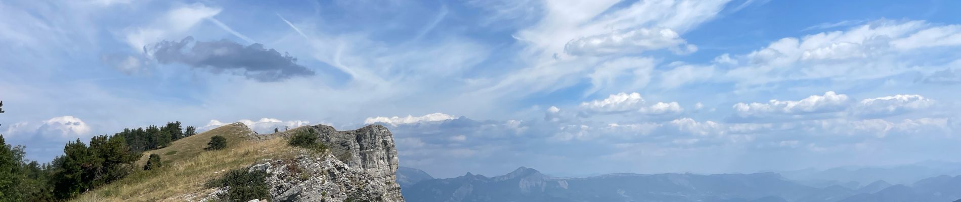
Col de Fontbelle Crête de Géruen

caze
User
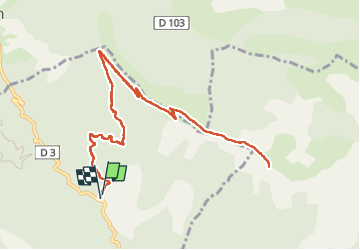

Length
14.2 km

Max alt
1880 m

Uphill gradient
673 m
Km-Effort
23 km

Min alt
1312 m

Downhill gradient
678 m
Boucle
Yes
Creation date :
2024-08-05 10:35:54.0
Updated on :
2024-08-05 16:42:12.247
5h18
Difficulty : Very difficult

FREE GPS app for hiking
 SityTrail
IGN / Geographical institutes
SityTrail Plus
The world is yours!
About
Trail Walking of 14.2 km to be discovered at Provence-Alpes-Côte d'Azur, Alpes-de-Haute-Provence, Le Castellard-Mélan. This trail is proposed by caze.
Photos


Positioning
Country:
France
Region :
Provence-Alpes-Côte d'Azur
Department/Province :
Alpes-de-Haute-Provence
Municipality :
Le Castellard-Mélan
Location:
Unknown
Start:(Dec)
Start:(UTM)
272165 ; 4899807 (32T) N.
Comments